(Image source from: Odishabytes.com)
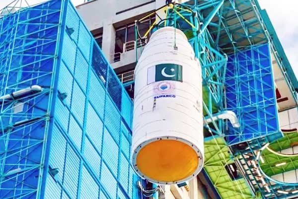
While Pakistan has quickly grown its ability to monitor from space with several satellite launches supported by China, India’s homegrown navigation system NavIC is facing its biggest challenge since it started, showing a noticeable difference in the space abilities of the two nuclear-powered neighbors. Although India is still stronger in other space-related areas compared to Pakistan, the recent satellite launches from its neighbor have caused worries within Indian government circles. In the last 16 months, Pakistan has sent up six satellites that observe the Earth, forming what experts call an increasingly capable system that can watch activities in Indian territory more often and accurately. These launches, many of which have received significant assistance from China, mark a significant boost for Pakistan's usually limited space program.
The increase in satellites started even before the Pahalgam terror incident and India’s following Operation Sindoor, indicating a long-term plan to improve Pakistan's ability to gather intelligence from space. Analysts note that the importance of the new satellite group is not just in how many there are, but in what they can do together. These satellites can take detailed images, monitor changes on land, spot hidden or disguised objects, and keep continuous watch over key military and strategic areas. "The group that has developed from this six-month surge is not just for civilian Earth observation that might have some military uses," wrote Rear Admiral Sudhir Pillai, a former Indian Navy officer, in his analysis of Pakistan's latest satellite launches. He pointed out that the design of the satellites, their sensors, and the support they receive suggest that they are intended for clear military and security purposes.
This swift growth occurs while India faces challenges with one of its key space projects, Navigation with Indian Constellation (NavIC). Created by the Indian Space Research Organisation (Isro), NavIC was meant to be India’s own solution to the American GPS system. The program was developed based on lessons learned from the Kargil War, when India saw the dangers of relying on foreign navigation services during military conflicts. NavIC offers Positioning, Navigation and Timing (PNT) services within India and goes about 1,500 kilometers beyond its borders, covering much of the Indian Ocean area. This system assists both regular users and encrypts military services utilized for important operations. However, by 2026, the system has reached a crucial point.